Walking route – Mont de Grange from Châtel

    Châtel

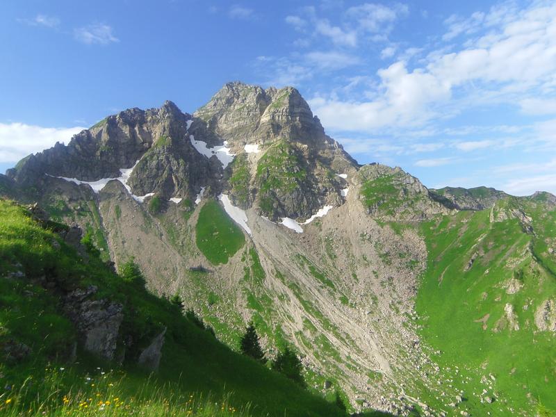
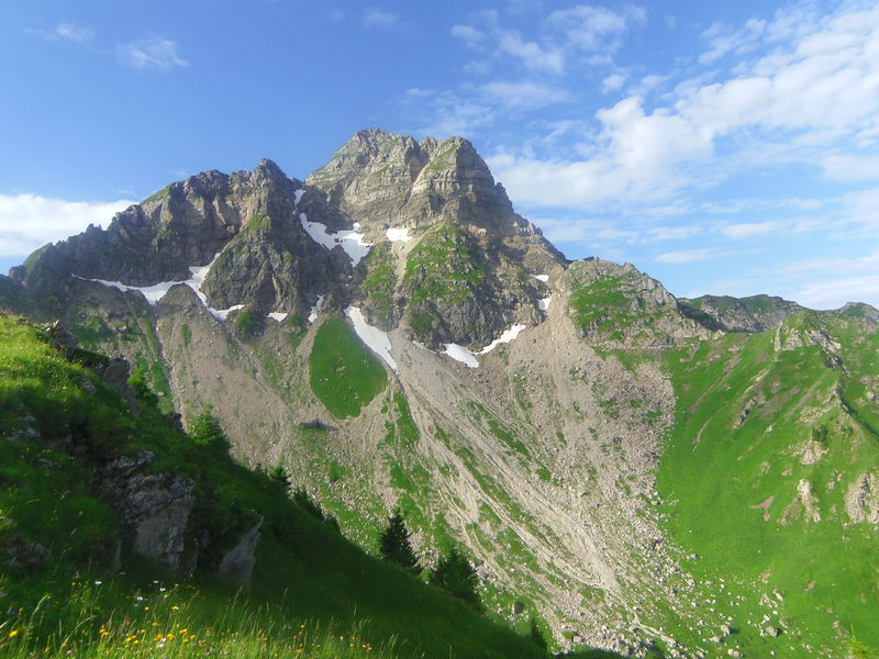
    This massive mountain is the highest peak in the Abondance valley (2 432 metres) along with the Cornettes de Bise.

    The breathtaking views from the top of the Mont-Blanc massif and the Swiss “4,000” (Monch, Jungfrau, Matterhorn, Grand Combin, etc…) will live up to your expectations.

    There is a striking contrast between the less hospitable north-facing slopes and the south-facing slopes, with their many mountain pastures.

    Start : The path is on your right 50 metres before the bridge from the Pré la Joux car park.
    From the car park, follow the track and then the fairly steep path up towards the Betzalin mountain pasture through a beautiful spruce forest along the stream. At the end of this forest, you reach the mountain pasture, only to return under the trees by taking the carriage path on the left above the chalet: this takes you to the Covagnes mountain pasture. Here you reach the sub-alpine level of the mountain environment.

    Pastoral activity is still present, in this case for the production of Abondance cheese. Take the path above the chalet, which winds up to a plateau, and turn right towards Lenlevay. The path then runs along the southern slopes of the Grange massif, from where you can gradually see Mont-Blanc.
    To get to Mont de Grange, a path rises on your left after about 1 km before joining the Coicon ridge.

    The path then winds up to the summit ridge, where you can enjoy one of the beautiful views in the Northern Alps.
    The return journey takes the same route.

    Read more

    Further information

    Whichever walk you choose, we recommend that you :

    - Wear appropriate footwear and always take with you: warm clothing, preferably waterproof, plenty of water, sunglasses, sun cream and a small first-aid kit.
    - Do not set off alone.
    - Inform someone living in the valley of your plans.
    - Do not change the planned itinerary indiscriminately. But do not hesitate to shorten it if necessary.
    - Carry a map and even a torch.
    - Check the weather forecast before setting off.
    - In the event of a thunderstorm, move away from ridges, passes and summits as soon as possible and never take shelter under an isolated tree.

    Services & Equipment

    • Car park
    • Free car park
    • Parking
    • Pets welcome

    Customer base

    • Walkers/hikers
    • Level red – hard
    • For experts / practiced

    Opening

    From 01/06 to 30/09.
    Accessible outside the snow period and depending on weather conditions. Check with the Tourist Office beforehand to find out the current access conditions. Recommended practice period: spring - summer - autumn.

    Animals

    Animaux : Accepted without supplements

    Dogs must be kept on a leash because of the presence of herds, Natura 2000 reserve and hunting reserve.

    Age range

    Minimum age : 16 years

    Adapted Tourism

    • Not accessible in a wheelchair

    Prices

    Free access.

    Location

    Pré la Joux
    74390 Châtel

    Recommended parking: Pré-la-Joux - Châtel The closest bus stop: Shuttle line 1, stop "Pré-la-Joux" (July & August)

    Characteristics :

    • Mountain location
    • Close to GR footpath
    • Mountain view